|
Let's Enjoy the Shibuya River Walk Aruku Shibuya Gawa
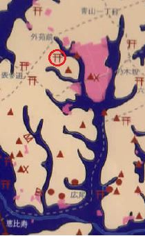
Ravel f 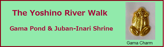 1. The three origins of the Yoshino River On April 21, we enjoyed a Shibuya River Tour from Gama Pond, Gama means toad, in Moto-Azabu to the Juban-Inari Shrine in Azabu-Juban area (*1). We walked along the tributaries, now culverts of the Yoshino River, which was a branch of the Furu River, the lower part of the Shibuya River. The Yoshino River flowed like meshes of a net in this area and had mainly three origins and flows. The first one started at the Roppongi Crossing area, the second one at the south western of the Roppongi Hills, and the third one from Gama Pond at southern Moto-Azabu area. We walked the third tributary from Gama Pond to Azabu-Juban area. These three tributaries surrounded a height in Moto-Azabu shaped like a pentagon. It was a former residence of Lord Yagyu who was the coach of the 3rd Tokugawa Shogun Iemitsu, both in military and politics. 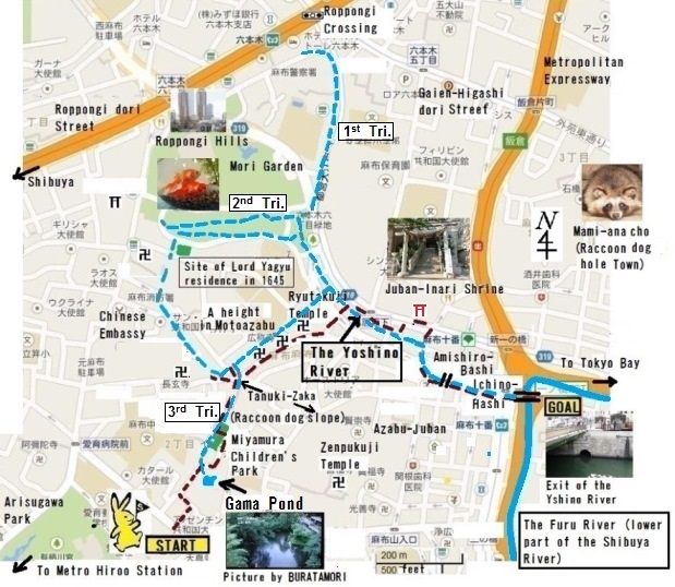 The area the Yoshino River flowed. The first and the second tributaries of the Yoshino River joined at the south eastern corner of Roppongi Hills and flowed along the eastern side of the height to the south as the main river. The third tributary from Gama Pond joined to the main river at the south eastern corner of the height. Then all three tributaries formed the Yoshino River, and flowed along the Azabu-Juban-Odori Street to the Ichino-Hashi, Furu River.
2. Gama Pond We started our tour at Hiroo Station and first
went to the Arisugawa Memorial Park (*2). The garden of the park was Japanese
style with an elegant pond and various cherry trees. Walking through the park under
the green leaves, the late cherry blossoms, we finally entered a parking lot in
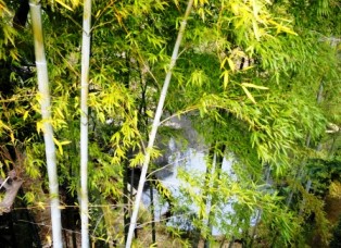
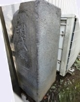
a residential area, from which we could see the Gama Pond. There we looked down at the Gama Pond, about 10 m
below, through the bamboo trees. We couldn’t enter the site of the pond because
it is a private land surrounded by apartments. Several decades ago, the third
tributary of the Yoshino River flowed out of the pond to Azabu-Juban.
Until the Meiji Era the pond was
unspoiled nature about 2/3 of an acre wide.
In the modern age of housing development, the pond’s size was reduced numerous
times. Several hundred foreign people living in the area opposed the plan along
with local people, but it didn’t work. Now the pond became about 1/10 of an acre
wide. It is a miracle that a small portion of the original pond has been
preserved until today. The Gama Pond has a legend
from the Edo period about 200 years ago. 3. Roppongi Hills and Mohri Garden We left Gama Pond and went in a northerly direction to the cliff above
Miyamura Park. Along the Miyamura Park area, the tributary from Gama Pond was flowing
several decades ago. From the cliff we commanded the vast landscape of Roppongi
Hills Tower very clearly against the wide sky. The tower was built almost 15
years ago as a grand condominium. We didn’t visit the Roppongi Hills that day, but
I explained about the history and the geometry of this area because the second
tributary flows from there.
Roppongi Hills is named “Hills”, but the southern part of it had been a deep valley and a tributary of the Yoshino River that
flowed there until the 1920’s. Many golden fish (kingyo in Japanese) breeders lived there
from Edo period and the river water was used for small ponds of kingyo breeding.
One big family had a branch store even in London. When a plan for the modern
Roppongi Hills was announced the kingyo breeders first opposed it because they
wanted to continue their business, but later cooperative for the development of
this area. After 17 years of planning and construction, Roppongi Hills was completed
and the tributary as well as the many small ponds all disappeared.
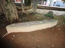
During the Edo period, the area of Roppongi Hills was a residence of Feudal Lord Mhori and had a big pond. Apart from the tributary of the Yoshino River, I introduced a famous story of the Samurai’s loyalty, the Forty-seven Ronin (“Chushin-Gura” in Japanese) related to the Mohri Residence. About 300 years ago, an affair happened in Edo. Lord Asano injured Lord Kira by sword who insulted Asano in the corridor of Edo Castle. Asano was punished and ordered to do seppuku (hara‐kiri) and his castle was confiscated by the Edo Shogunate Government. After a year, the Forty-seven Ronin revenged their master Asano, raiding Kira’s residence in the snowy midnight and killed him. Government decided to punish them again and 10 of them performed seppuku by the pond in Mohri’s garden. Edo people admired the loyalty of the samurai very much and created a famous Jyoruri or Kabuki program of this story. Up to the present time people love the Forty-seven Ronin Legacy and have been making many new dramas and movies. Now the pond in the garden has been remade and the old pond is being preserved under the new pond. When talking about this, one lady said, “There is a stone monument of the Forty-seven Ronin in the Italian Embassy!” Italian Embassy in Mita, Lord Iyo-Matsuyama’s residence in Edo period, was the place of another 10 Ronin to perform seppuku. To my surprise, the stone monument was built by the Ambassador because he was deeply impressed by this story.
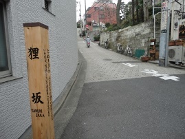
4. Miyamura Children’s Park & Tanuki-Zaka
Leaving the Miyamura Park, we walked to the exit
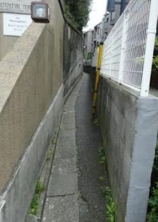
of the culvert at Tanuki-Zaka (Raccoon dog Slope) directly. The culvert area
was too narrow even for one person to walk. But surprisingly, kids streamed out
of the mouth of the culvert when we reached the exit. They were cute foreign
children having an adventure with teachers in the small lane!
Incidentally, Tanuki-zaka has a funny folklore
during the Edo period that a veteran old tanuki lived nearby which liked
bewitching people. The tanuki changes a shape of a stone or jizou, a stone deity,
into a baby with his magic and puts it on the road. A passer-by finds an
abandoned baby and takes him up and carries to the slope, then he/she notices the
baby is a stone. There used to be many stones and jizou scattered on the slope.
Azabu area had two or three other tanuki stories and even Tanuki Senbei
(Japanese cracker) shop along the Azabu-Juban Odori Street we are going to.
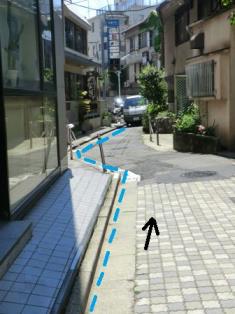
The tributary, all culvert now, flowed from Tanuki-Zaka to Azabu-Juban
Odori Street, at the foot of the southern side of the pentagon shaped height.
We walked along the street parallel to the tributary, passing in front
of the temples and small shops. After a few minutes’ walk, we entered the
lively Azabu-Juban Odori Street. The tributary flowed in the back of parking
lots and the buildings and crossed the street at a bakery, Montabo, where
there was a bridge called Amishiro Bridge until 1928. It entered the Furu
River at Ichino-Hashi after flowing about 200m. We left the tributary and
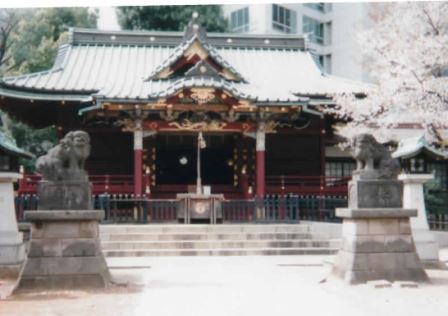
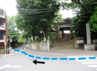
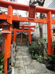
went to the Juban-Inari Shrine near there to know more precisely about
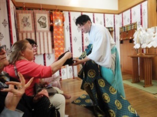
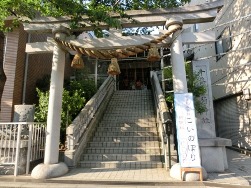
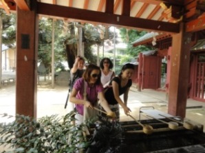
the culture and the history of this area. 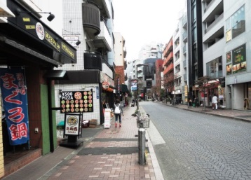 The lively Azabu-Juban Odori Street with lot's of food shops. 5. Juban-Inari Shrine We walked about 200m to the east along the Azabu-Juban Odori Street, then turned left and came to Route 319, to which the Shrine is facing. We reached a big Torii along the road and entered the Shrine climbing up the stone steps. There was a main hall at the top of steps and were two guardian dogs, Komainu, in front of the hall. We washed our hands first and rang the big bell and worshiped following Shinto’s tradition. There were also several talismans in the showcase, one of which was originated from the legend of Gama Story and had been distributed for almost 200 years. Even now, Gama Talisman is written with black sumi ink with the very water of Gama Pond. It is amazing!
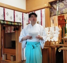
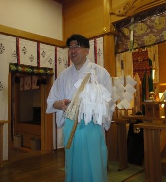
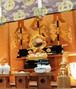
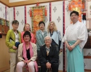
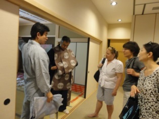
Priest Yoshida greeted us and kindly invited us into the inner shrine. We took off our shoes and entered the hall. The wooden floor was kept with the utmost cleanliness and all the walls were covered with colorful hung clothes. A bright mirror with golden frame and ornaments were enshrined on the Altar and we found some offerings of rice, kelp, sake and others in front of it. Priest Yoshida explained to us the history and essence of Shinto as well as a history of Azabu areavery plainly and attractively. It is regrettable that I cannot show you the whole of his precious talk. On the day, his lecture was interpreted by Hiroko Ikegami.
The inside of the Main Hall was very cozy and we
got ready to listen to his speech. First of all, he talked about the long
history of Shinto. “The origin of Shinto
goes back to Jomon Period in the New stone Age, though we cannot confirm it
clearly. It began with the
sense of fear and respect for natural phenomenon such as divine mountains, the
falls, the rocks and etc. Before Buddhism was imported to Japan, Shinto didn’t have shrine buildings but later they built it called Yashiro, due to the influence of the temple style of Buddhism, where Kami-sama exist at all times. On the occasion of a ritual, priests dedicated a prayer called Norito to Kami-sama in the building and performed a ceremony. This style of Shinto ritual keeps until today.
In Shinto, ritual of purification is very
important. The priest showed us a pole attached to the white long papers like
feathers. “When priests have a ritual, they shake this pole to purify
uncleanness, disaster and etc. The mirror on the Altar symbolizes a virtue of
honesty and is an instrument for a visitor to worship Kami-sama with a pure
heart. Komainu, the guardian animals in front of the main hall that drive away
the evil spirit. In that purified place, a priest serves a meal to Kami-sama
and recites Norito. When someone asks a shrine to pray for a safe birth or a
safe construction, a priest performs a ritual and informs his/her wish to
Kami-sama reciting the Norito which includes the person’s request written on
the paper. A priest is like a medium between Kami-sama and people.
By the way, he showed us his traditional dress.
His black cap called Eboshi looked heavy but we were so surprised when we held
it. It was really light! He said that it was made of paper with lacquerware. He
put on his traditional dress, called Kariginu and said, “They made the sleeves
so wide that we could stay cool with good ventilation.”
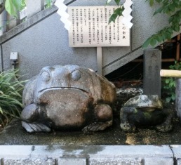
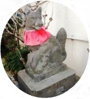
When we got out of the Shrine and returned to the
Torii, we found there were a cute stone figure of a toad and a main pole of Amishiro
Bridge by the steps. The Shrine keeps the legend of Gama Pond and the memory of
the Yoshino River as historical items in Azabu area. We couldn’t reach the
Ichino-Hashi Bridge because of a tight schedule. The Yoshino River flowed near the Shrine and
poured into the Furu River at the Ichino-Hashi Bridge. I would like to say thank you to Hiroko-san for interpreting
the Priest’s lecture and Chris Kim
for her kind language advice on this paper.
(*1) Azabu is the name of this area and “Juban” means the 10th
in Japanese. In 1676, the Furu River was widen and deepen for the ships to
enter and transport goods from Tokyo Bay to Ichino-Hashi. The name of Azabu-Juban
came out of the 10th construction part. (*2) The
Arisugawa Memorial Park was owned by Feudal Lord Nanbu in the Edo period, then
became a residence of Prince Arisugawa Takahito in the Meiji Era and then was
donated to the Tokyo Metropolitan Government as a public park. 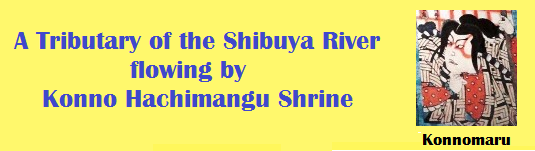
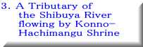
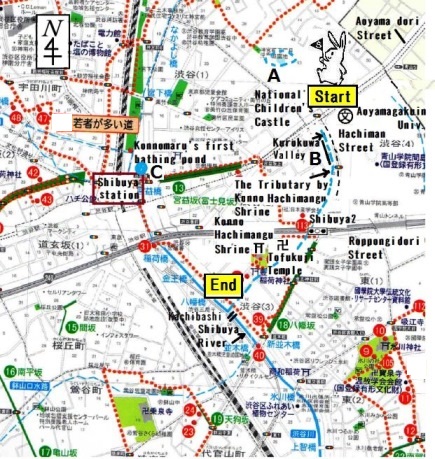
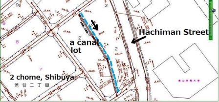
1. Geology of the Tributary One fine day we walked along an old Tributary of the Shibuya River, which is now a culvert, flowing by Konno Hachimangu Shrine and Tofukuji Temple (3-5 Shibuya Shibuya-ku) in the center of Shibuya, Tokyo. The Tributary started at the southern vicinity of Aoyama-dori Street by the western side of Aoyama Gakuin University, and poured into the main Shibuya River near Shibuya station until the mid-20th century.
Date: June 3rd,
2014
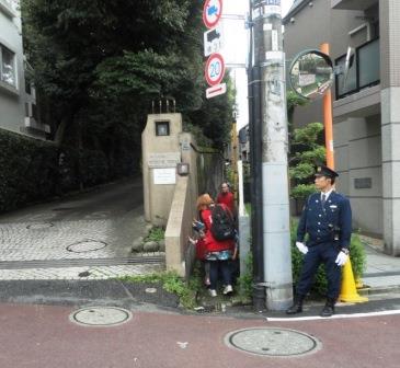
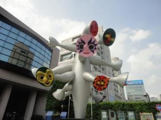
We started from Omotesando Crossing and walked along Aoyama-dori Street
on the northern side for about 5 minutes. We reached National Children's
Castle (Kodomo-no-shiro) and found a sculpture displaying happy faces:
“Tree of Children” created by Artist Okamoto Taro.
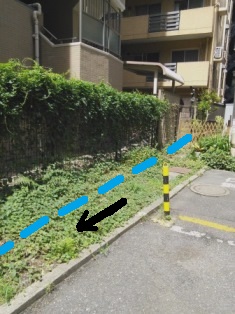
We crossed the Aoyama-dori Street by Aoyamagakuin-mae Walking Bridge and entered narrow Hachiman Street curving to the south. The Tributary of the Shibuya River was flowing by Hachiman Street which was a section of the ancient Kamakura-kaido Road used in 12th century and later (1) . Meanwhile, this place was called Kurokuwa Valley in the Edo era. The valley was deeper than now, and there, the tributary flowed into the bottom of it. Kurokuwa, which originally meant a thick hoe in old term Japanese, was also the name of the people who lived here engaging in a public construction work for Edo Shogunate.
2. The river signs
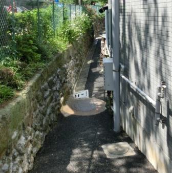
We walked along
the Hachiman Street about 70m and entered to the parking area to the back of the
Aoyama Alcove building at the right side. There was a sign of a culvert with
soil and grass at the deepest area. “Here it is!” I pointed to a narrow
1.5m-width space which extends along the fence. It was a 90m-long remain of the
old Tributary in the Shibuya City
Cultural Map above (B on the map). The origin of the river is supposed
to be near here. The river would have been in the bottom of far deeper valley
when this place was called Kurokuwa Valley. Someone asked me
“How do you know this was an old flow?” I replied that I made sure this site is
a canal lot by consulting
the Sewerage Ledger Map (2). Furthermore, I know Mr. Asatsuma’s first-hand experience of river.
He is the president
of the neighborhood association and was born in Shibuya. He said to me, “I saw a narrow stream
in about 1940, when I
was a 4 or 5-year-old kid, in the backyard of present Aoyama Alcove. My friends
and I often played, making bamboo leaf boats and floating them in the clean
stream.” According to him, all the northern flow of the Tributary above present
Roppongi Street became a culvert in 1950 because of readjustment of
the town. Since then, this 90m-long culvert space has been owned by public (MLIT ) (3).
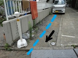
After we saw the culvert in the parking lot, we returned to the Hachiman Street and walked another 50m to the south. There we checked the exit of the culvert, where soil and gravel open to the road which goes down from the Street. “It is under the buildings hereafter, isn’t it?” someone said. Yes, it is. In Cadastral maps of Shibuya Ward (4), the Tributary went almost straight to the facing block, where many buildings are now standing. Actually, this
area has plenty of water nowadays. For example, there is a well in this area
from which the water gushed forth so much that the owner had to control it
because of the hyper sewage charge! Another story describes that one person
closed the well after doing some exorcism rite, the traditional Shinto ceremony in Japan.
In those days, the river flowed gathering a big amount of water and crossing underneath
present Roppongi Street, and then continuing to Tofukuji Temple and Konno
Hachimangu Shrine. We walked along the river full of imagination. 3. Tofukuji Temple
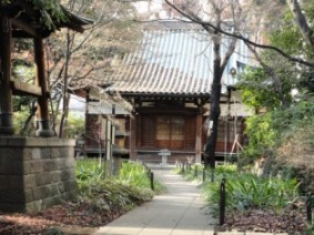
We crossed Roppongi Street at the Shibuya 2-chome intersection. Following the Tributary, we walked along the Street to west for 50m and turned to the south to Tofukuji Temple. The Tributary became culvert earlier (in about 1920) in this area from the other side of the present Roppongi Street, where there is no sign of a river today. After flowing underground and passing in front of Tofukuji Temple, the Tributary appeared on the ground at the Konno Hachimangu Shrine next to it. A priest of Tofukuji Temple said to me that there was a bridge at the gate of the Shrine, and from there the river appeared through the big conduit which he enjoyed exploring so often in his childhood. Part of the bridge still remains. We visited the Tofukuji
Temple which was established in 1173. The temple was Bettoji of Konno Hachimangu Shrine,
which means a temple together with a shrine, the Japanese tradition of the syncretism of Shinto and Buddhism. When
I explained about the syncretism, one friend said, ”Japanese is born Shinto, gets married as Christian, then dies as Buddhist.” (laugh!) We entered the
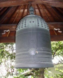
Temple and saw a large bell (Bonsyo), made in 1704, hung in a wooden tower. It was
and is an important bell for Shibuya-ku as it has Shibuya’s history carved onto
it in old Chinese characters. According to the comments by the Shibuya
Municipal Board of Education, this whole area was called Yamori-no-sho in 11th
century, and was divided into seven regions one of which was Shibuya.
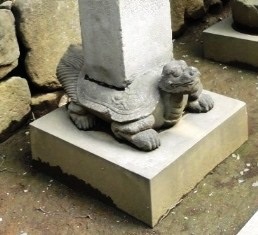
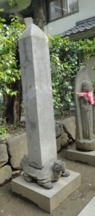
There was another interesting thing in the entrance area. It was a stone
animal like a turtle which was under a heavy pole. One friend said “A turtle?
Not a turtle, a dragon!? What is this?” I researched later and discovered
it to be a “Hiki,” a
Chinese mythical animal, which is a child of a dragon and likes to hold
something heavy! In China, it is often used as an ornament for a pole. The modern
Japanese word “hi-i-ki” came from “Hiki” phonetically changed, which means
patronage for sumo wrestlers, Kabuki performers, or partiality to favorable
persons.
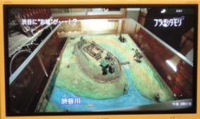
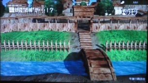
The Shibuya Castle
was not a big castle with a tall tower, but it had been at a good location
being protected by the 2 rivers as a moat, the main Shibuya River and the
Tributary we are walking along. A popular NHK program Bura-Tamori featured the Shibuya River in 2011 (5). In the program, we could watch
the Shibuya River flowing brilliantly before the Shibuya Castle’s gate
and protective fence in the CG scene.
In the middle age,
there were several ponds in this area because of plentiful water, one of which
called Konnomaru’s First Bathing Pond appears in Edo-meisyo-zue (6). According
to History of Shibuya Ward, the place
of the pond was likely to be at point C on the map. There was another one
called Konnomaru’s Pond for Cooling-Down-His Steeds nearby.
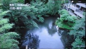
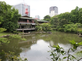
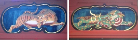
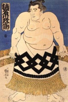
When we reached the Konno Hachimangu Shrine, we first washed our hands with water at an ablution pavilion by the gate. There was a cherry tree by the main building. One priest explained in English that the cherry is called Konno-zakura and blooms with both single cherry blossoms and double cherry blossoms at the same time on one tree. It has been planted for generations by seedling. It is amazing! The priest explained about the main building, which was painted red with lacquer and had some sculptures on the upper part with animals. The tiger at the left side is a symbol of justice in politics, and a mythical tapir (Baku) at the right side represents peace. In China it is said that Baku, a mythical animal, eats iron which suggests arms. As Baku was so intriguing, I looked into Baku later and found interesting details about it. According to a researcher of old Chinese archives on the internet, the origin of Baku seems to be a Giant Panda (7). Baku is described as having a small head, short legs, white and black patterns, and eats bamboo, copper, iron. That’s amazing! In Japan, Baku is said to eat nightmares.
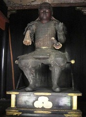
The present shrine building was dedicated in 1612 by 2 important figures in the Tokugawa shogunate regime. One was the 3rd Shogun Iemitsu’s wet nurse Lady Kasuga, and the other was Lord Aoyama Tadatosi, the 3rd Shogun’s assistant, and his family name is the origin of the town name “Aoyama”. We also saw a “Kogai,” a hair ornament for ladies or a tool for samurai to carry with his sword, in the treasure house of the Shrine. An interesting history of this Kogai is mentioned in the article “The Hidden Kogai River & Legend of Aoyama area,” 3/22/2014 in this Topics site. Luckily we were invited to a guest room in
the Konno Hachimangu Shrine. We saw many traditional dresses of priests drying
on the tatami mattress in the next room. We got interested in the colors and
patterns on them, which were beautiful cranes, pine leaves and etc.
Mr. Tadokoro, the priest explained the essence of Shintoism. “We are all
born pure but become dirty gradually in the process of growing up. Shinto
washes people’s dirt thereby restoring their purity so to enhance understanding
of and respect for Nature.” He explained that the Shrine succeeds the regional
culture and history, and makes a big effort to maintain its own treasures,
traditional crafts, and architecture. After he shared these precious stories,
he served us tasty tea. It was a really unforgettable time for us. One
friend wrote to me later “It was wonderful getting a "behind the scenes"
and so warm and gracious of the priests to give us so much of their time
as well as the added treat of tea.” Thank you very much, Mr. Tadokoro,
for your interesting lecture and exquisite “Omotenashi.” After tea, we
saw a piece of an old stone in the precincts of the shrine. It was a piece
of the bridge which had been down in front of the steps of the Shrine until
almost 70 years ago. 5. Meiji dori
Street We walked to the
last point, Meiji dori Street near the main Shibuya River. The Tributary of the
Shibuya River was flowing along the Shrine and down a slope to the River by the
Kachi Bashi Bridge. Today, the culvert does not reach the River, but is flowing
into the Main Drain Pipe under the Meiji dori Street.
(1) Kamakura-kaido Road was
mainly used in the Kamakura Period which started in 12th century.
In a time of civil war,
samurai living in the Kanto area gathered quickly to
Kamakura Shogunate
through the road. Kamakura Shogunate was the first government in Japan by
samurai. Until then Emperors and noblemen were the rulers. (The End)
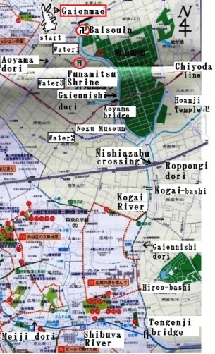
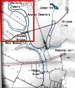
1. Our route One sunny fine day, I invited some of my friends to go walking along the
Kogai River culvert, which was once a tributary of the Shibuya River (the
Furu River). We walked for a short part of the culvert at the west side
of Aoyama Cemetery, in Minato-ku, center area of Tokyo. We followed the
water flow drawn on Shibuya City Cultural Map below (1). The route was : Metro Gaien exit 1a (Aoyama dori)→Baisoin Temple→an origin of the Kogai River (back street of
Gaiennishi dori)→Minato-ku Minamiaoyama 3 Chome Green Space→a culvert of
the Kogai River→Funamitsu Shrine. Then we returned to Aoyama
dori. It took almost 1 and half hours.
2. Baisoin
Temple
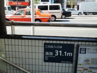
First we came to Metro Gaien Station exit 1a and saw a sign on the wall.
On the sign sea-level number 31.1m is written. In this area there used
to generate plenty of water naturally from around this height. That is
because the Shibuya layer of clay stays under the ground. Rain water got
into the ground only to stop on the surface of the clay layer and then
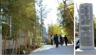
slid and flowed down at the cliffs. Some of water still generates today (3). Before starting the culvert walk, we visited Baisoin Temple by the Aoyama
dori through its long bamboo aisle. Someone said that she thought the temple
a gorgeous restaurant and another said a wealthy person’s residence. In
reality it has been a famous temple since early Edo period, and was described
beautifully in Edo Meisho Zue (4). It was Lord Aoyama’s family temple since
the early Edo period, mid-17th century. Lord
Aoyama owned this area, nowadays called North and South Aoyama, as his
residential site (5). Part of it became Aoyama Cemetery in 1872 just after
Meiji Restoration.
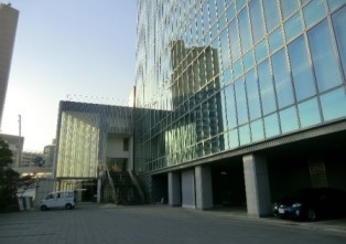
The
entrance appeared at the end of the long bamboo aisle. The temple in the
deepest place was a very modern architecture with big glass walls, which was
built newly in 2003. At first we saw a little
pet cemetery building near the gate. On the wall there are many pets’ names
which are sleeping inside quietly. The ladies were very interested maybe
because they each have their own pets. One of the ladies said “In Denmark
we also have this kind recently but not in the past. I guess it is very
expensive here.” We entered
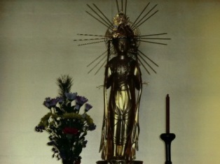
the Kannon-do room in the main building and saw new beautiful Kannon (Buddhism
statue). I explained that old Peace Kannon stayed
here and was admired very much but, burnt down in the World War Ⅱ. Some of them sighed for it, “It is so regrettable
not to see the old one.” Then we started to the Kogai River culvert. Aoyama
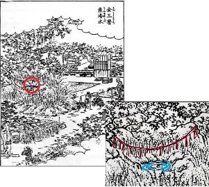
Cemetery is on a height. Little streams started from both of the western and
eastern side of Aoyama Cemetery (See the upper right map). They were origins of
the Kogai River. One of them started from a backyard of Baisoin Temple. 3. Culvert walk
Aoyama Cemetery is on a height. Little streams started from both of the western and eastern side of Aoyama Cemetery (See the upper right map). They were origins of the Kogai River. One of them started from a backyard of Baisoin Temple. After seeing
the Temple, we got back to Aoyama dori and entered to a little aisle by the Gaienmae
walking bridge. The aisle is next to the backyard of Baisoin Temple and this
area was the very site of the origin of the Kogai River (see red circle in upper
left map). Then the flow became 2 parallel streams A and B in the map. We
followed the A stream, now culvert,
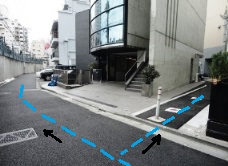
which crosses the Gaiennishi dori to the south. The culvert, paved with concrete
and stone, reached to the Gaiennishi dori. We went up the steps and found another
steps down to the culvert at the opposite side. We crossed the street and stepped
down by Sports Club RIVIERA, Italian company’s branch. Meaning of “RIVIERA” is
a coast of river or lake in Italian. What an amazing coincidence! We reached
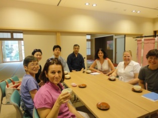
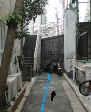
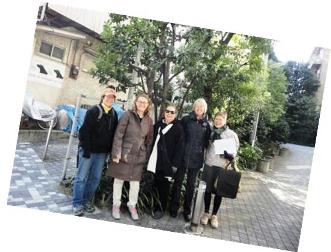
a cozy area ‘Minato-ku Minamiaoyama 3 Chome Green Space’ next to the Club. We took
a picture of us for memory. One member said, “I can easily guess that this is a
culvert because I walk my dog here often and can hear the sound of water
flowing!” The old tributary
keeps to flow to Nishiazabu crossing and to southern direction, joining other
western flows.
4.
Funamitsu Shrine After we walked about 100 m, we departed from the culvert and turned right
to visit Funamitsu Shrine.
It is on the western slope of the culvert. We walked up for 100 m again
and found the Shrine with charming red tori gates on the right (Minami-Aoyama
3-4-11). There were two foxes at the both sides of inner tori. They said
“How cute!” One fox held a cube and the other held a baby fox. Meaning
of the cube is a spiritual power and the other, to be blessed with children.
The
Funamitsu Shrine has an interesting legend related to the name. “Funa” means a
ship and “mitsu” means light. Someone said “A ship? Then was there water?” Yes,
there was. According to a history of this shrine, they had a harbor here and
ships went in and out in 8th century. One day, there came a big
storm and a ship was drifted nearby and about to wreck. All of a sudden, a
light came from the Shrine and the ship safely reached the harbor.
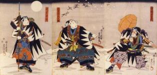
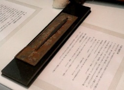
5. Origin
of name of the Kogai River In the medieval times, there was a bridge called the Kogai bashi (Kogai
bridge) about 1 km south of the Funamitsu Shrine. The river name “Kogai”
was from the bridge’s name and kogai is originally a hair ornament or a
tool. (See the top picture.) There were 3 stories about the origin of the
Kogai bashi name in Edo period. The 1st
story was on defeating of the ogre at the bridge. In the mid17th century,
there lived a wealthy person called Shibuya Millionaire and he restored
Funamitsu Shrine
in those days. He
had a beautiful daughter. One day she fell in love with a young man and they
had a date by a bridge. Then an ogre attacked them. Suddenly a young soldier
appeared from nowhere and defeated
the ogre for them. He was a
spirit of Kogai tool, which the young man had gotten when he visited the
Meguro-Fudo shrine. After finished his job, the Spirit returned to his original
figure, Kogai tool, and disappeared to the River. After that, the bridge was named
Kogai bashi. Kogai was used in old days by both of man and women. They used kogai to arrange their hair or scratch their head. Their hair was so hard with oil in Edo period that they couldn’t scratch without a tool like kogai. Someone said, “Oh, I once touched a Sumo wrestler’s hair. It was very hard like a helmet ! ”
Why did the Kogai bashi have so various stories though it was a tiny 4
m long bridge? Perhaps this bridge was at the very strategic point between
Kyoto, ancient capital, and Aoyama and deep Kanto area in those days. 6. Closing After we
visited the Funamitsu Shrine, we returned to the Aoyama dori where we started and finished
the tour. However, the culvert of the Kogai River keeps flowing to the Tengenji
Bridge at Meiji dori, and there flows into the Shibuya River (Furu River). The
Kogai River became a culvert after the Great Kanto Earthquake in 1923 and Tokyo Olympic Game in 1964.
But it still remains flowing under the ground with lots of histories and stories.
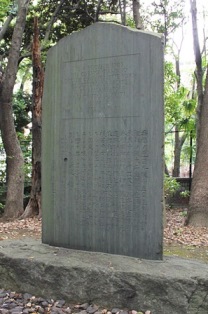
(1) Shibuya Folk and Literary Shirane Memorial Museum.
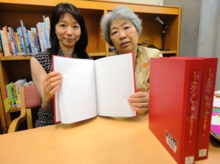
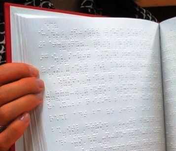
On April 2011, I received an e-mail from my longtime friend Fusako Hatsuta. The mail informed me that my recently published book How to walk the Shibuya River had been chosen to be translated into Braille. Fusako has been a longtime member of ‘Uehara Tenji-no-Kai’, a volunteer group that translates books into Braille, indeed, tenji means “ braille points.” She also wrote about her surprise to discover that it was my book that was selected by the association’s leader, Yukari Morita, and that what a happy coincidence it was that she could translate her own friend’s work It took Fusako and Yukari a long time to translate How to Walk the Shibuya River. But finally, this past fall, September 2012, they informed me that the translation and binding was completed. They extended an invitation to me to view the new version. I visited the Shibuya City Library, Chuo, where they had been working and where the book is now kept. It was a pretty red and in three volumes. How nice the book was! I was so grateful.
Yukari Morita informed me that “The book was translated by three translators spending a half a year, and the proof reading was done by three other editors.” We do have software to translate into Braille. But before using the software we need change each kanji, Chinese character, into kana, its phonetically equivalent letter. Names are especially tricky since the reading of names written in kanji is sometimes very different from their exact translation. This was the main cause of such a long year in the making of the book.” Then she explained how she discovered the book. “I found it at the Kinokuniya bookstore in Tokyu Plaza, Shibuya, Tokyo. The book had occupied a prime spot on the front shelf for new publications and I felt that it was very interesting to read the old river stories with their academic explanations. Our group is focusing on books which have a connection with Shibuya City and I felt that when one reads this book one can better understand the real character and history of the town. She
also spoke about her important work. “In Japan nowadays, almost 80,000 books
(including magazines) are published in a year formally, but only 14 % are
translated to Braille. The ratio of Braille books must increase so that all the
people may access the modern culture expressed in the books of the library.”     ravel b
This is a record of a short presentation on the 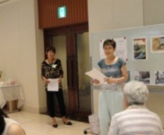 The Shibuya River has a history. The Shibuya River has a history.
 A tiny river near Shibuya Station A tiny river near Shibuya Station
I came to know
that this river is called the Before 1964 it was a dear old river. The river was natural and with people. I introduce you one little story from the book. Uta-san who lives nearby Ebisu Station talked this story to me. After the World War 2, there used to be a fire tower next to From now I‘ ll
show you pictures of the river which are covered and uncovered.
2. The right side flow in the map was flowing from Tamagawa city water way
and flowed under the pathway (see the below picture) just outside of 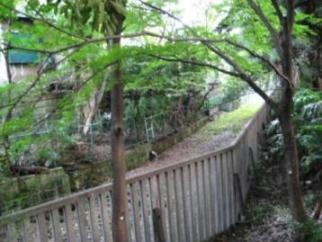 The pathway The pathway3. This pond is the lowest pond in 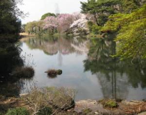 4. This is Naito Shrine outside 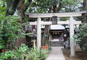 Naito Shrine Naito Shrine5. This is Kiyomasa’s well inside Meiji Shrine. From that place the water
is still flowing and we can see it. But in reality, you cannot see the
well. Why? Because it has become one of the famous power spots in Shibuya.
It is so popular that people stand in line very early morning and has to
stand 3 to 5 hours to see the well. They are sure that the picture of the
well in their keitai gets them happiness. So it is impossible to see the
well. Don’t you think so? 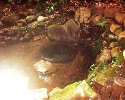 Kiyomasa’s Well Kiyomasa’s Well6. The water is still flowing under this interesting street Brahms’s Lane,
which is very close to 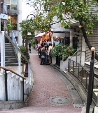 Brahms’s Lane Brahms’s Lane7. This is the Cats’ Street, covered river, crossing with Omotesando by Chanel. 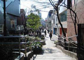 Cats’ Street Cats’ Street8. This is a picture from 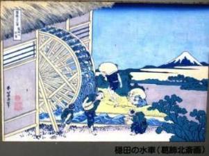 Onden’s Water Wheel Onden’s Water Wheel9. This is a continuous part of the Cats’Street, where the water wheel turned.
 The water wheel turned here. The water wheel turned here.10. They say there used to bloom Kohone
flower, a kind of lotus, in the 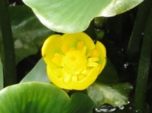 Kohone flower Kohone flower
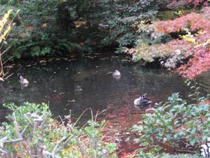
11. There is a little pond in the Syoto Park. You can see carps, ducks and a water mill in the pond. Still now there is a little spring water. Once the water flowed into the 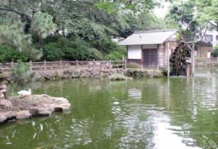 The Syoto Pond The Syoto Pond12. From Shibuya Station walk along the 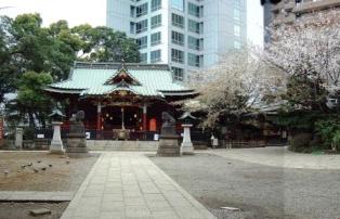 Konno Hachiman Shrine Konno Hachiman Shrine13. This is a pond in  The Rinsen Park The Rinsen Park15. This is a picture of Hiroshige at Shinohashi. The title is ‘Hiroo Furukawa’. In this area, the name of the Shibuya River was changed to the Furu River (Furukawa). This is how it looked 200 years ago. The two-storied house is said to be an eel restaurant. In 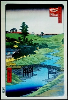 Hiroshige at Shinohashi Hiroshige at Shinohashi
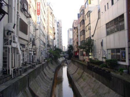
16. This is the present day of Shinohashi. The Furu River is under the high
way. 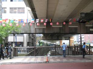 The present day of Shinohashi The present day of Shinohashi
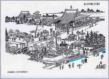
17. This is a pond in 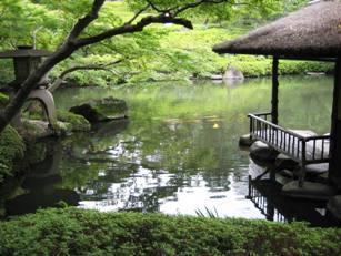 18. This is Shiba Zojyouji Temple. This is dedicated to three Shoguns of Tokugawa. 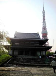 Shiba Zojyouji Temple Shiba Zojyouji Temple
19. This is Daimon Gate. One of the tributaries was flowing in front of Daimon
Gate. 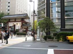 Daimon Gate Daimon Gate
20. In this 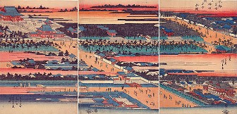 Hiroshige at Shiba Zojyoji Temple Hiroshige at Shiba Zojyoji Temple
21. We can see the fishing boats from 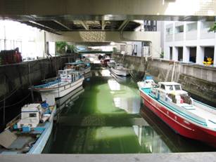 Shogenbashi Shogenbashi 22. The 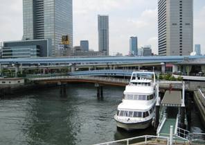 The Shibuya The Shibuya Thank you very much for your kind attention.
1. Summer’s come 2. Cradlesong A view of Shibuya River at JR Shibuya Sta. from the bridge out of Southern exit. About 80 years ago, there were lots of hills and valleys west of Meiji Shrine and even pastures. You could hear moos rather than horns. There was a lot of open space where you could pick greens and play baseball among rice and crop fields. The next song “Balmy breeze”, picturing such a scene, was created by Kusakawa, Shin, a young violinist teaching at an elementary school in Shibuya in about 1920. He is the same composer of the Cradlesong which Aiko sang a few minites ago. 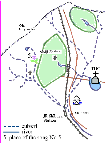 Well, there used to be a big pond here. You know, our place was right in the middle of a pond full of water. Are we now floating? No, it is not now, but in old times. Higuchisan said, he struggled with some underground water about 1 year ago. The water all of a sudden started to ooze out of the basement wall and made a puddle. He pumped the water out and made a little path for the water from outside the Fellowship Hall to the drain nearby. He doesn’t know the reason why, but we still now see some water coming from the soil. In the old times, in the Shibuya area, from here and there, much water sprang out. Not gold but water. However, in a sense, it meant a kind of money because the water raised crops and vegetables. Also it generated rather big power by water wheels. In the late 19th century, water power was very useful to polish rice and grind medicine and other uses.
The picture is an ukiyoe of a water wheel by Katsusika, Hokusai. They say
this water wheel was nearby, the exact place was not identified though.
Anyway, it generated power and made this area rather advanced. It helped
rice merchants very much and a part of the profit from water wheels was
used to build and run their first elementary school in the Meiji era. 3. The water wheel in the woods of green 4. A Balmy Breeze 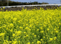 There were wide rape blossoms fields in Yoyogi-uehara In the old times, the western part of Shibuya was called Yoyogi Ninety-nine
valleys or Nishihara Ninety-nine valleys because of lay of the land. The
hills were steep and the woods were deep. From one of them a spring flowed
and the water gathered and became larger. Then it flowed into Shibuya River.
At the upper part the banks used to be full of flowers and there were fish
in spring time. There was one doctor who strolled everyday with his little
grand daughter in the area. He created a pretty river song for her. It
was very popular when spring came. Now fish grew a little bigger and greens
are deep, because the season moved. But please listen to a song with sounds
of sara-sara. Sara-sara is an expression of murmuring water.
Now
Aiko sings the last song which describes a beauty of la Seine. Under
the sky of Paris, you hear a chanson by lovers. Philosophers sit under the
Bercy bridge and musicians play the accordions. Under the sky of Paris the
river flows with joyful air. The sky color is its secret of the blue dress… Hoping
Shibuya River becomes as beautiful as la Seine, Aiko sings the song “Sous le
ciel de Paris”.
  Encore song was 'Summer's come'. We sang the song together and were very happy. (The End) Music Words A Little Brook in Springtime Saying to flowers, “What nice blooms!” violets blooming on the banks Saying to renge you have such graceful figures with good hues “Flowers, now time, bloom and smell,” murmuring, warbling, whispering,
it flows. 2. Flows a little brook in springtime, sara-sara nagaru Saying to shrimp and medaka, “Now staaay all day in the sun.” Saying to fish “Play all together, and amuse yourself in swim in a school” Haru no ogawa 1. Haru no ogawa wa sara sara nagaru Kishi no sumire ya renge no hana ni Nioi medetaku iro utsukushiku Sakeyo sakeyo to sasayaku-gotoku Ebi ya medaka ya kobuna no mure ni Kyoo mo ichinichi hinata de oyogi Asobe, asobe to sasayaku-gotoku
A Balmy Breeze(みどりのそよかぜ) 1. Comes a balmy breeze o’ er fields of green,what a wonderful day ! Butterflies dance over the fields Come out flow’rs of bean In the rainbow colored field, Sister picks soft greens Lovely hands, I see at distance standing in a breeze
How well did I play ! Now, my turn to hit the ball, slide to second base Safe! Being on the base, I wipe the sweat off my face
Midori no soyokaze 1. Midori no soyokaze iihi dane Tyotyo mo hirahira mame no hana Nanairo batake ni imooto no Tsumami-na tsumu te ga kawaii na 2. Midori no soyokaze iihi dane booru ga pon-pon sutoraiku Utaserya nirui no suberikomi seefu da odeko no ase wo fuku The water wheel in the woods of green 1. You can hear a merry song from far woods of green Water wheel is, turning round, singing all day long Lively sound is in the air, cheering you up Listen to his merry music, what he does ever mean? (Refrain) Fa mi le do si do re mi fa Koto-koto-kotton, koto-koto-kotton Work hard all day long Koto-koto-kotton, koto-koto-kotton I know comes a day Happy, wonderful, springy day soon comes along 2. Turns and sings the water wheel, beyond the woods of green Keeping time with powder mill, sings a merry song Even through a rainy day or all windy night In a happy way he keeps singing his joy song (Refrain)
Mori-no-suisha(The water wheel in the woods of green in Japanese) 1. Midori-no-mori no kanata kara Yooki na uta ga kikoemasu Are wa suisha no mawaru oto Mimi wo sumasete okikinasai (Refrain) Fa
mi le do si do re mi fa Koto-koto-kotton,
koto-koto-kotton Koto-koto-kotton,
koto-koto-kotton Itsu-no-hi ka tanoshii haru ga Yatte kuru 2. Ame-no-furu-hi mo kaze-no-hi mo Mori-no-suisha wa yasuminaku Konahiki-usu no hyooshi tori Yukai ni uta wo tsuzukemasu (The End)
(English by Kimiko Kajiyama) Copyright © 2014 Kimiko Kajiyama All Rights ReservedA |
||||||||||||||||||||||||||||||||||||||||||||||||||||||||||||||||||||||||||||||||||||||||||||||||||||||||||


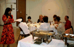
 At a meeting room in Izumi Garden
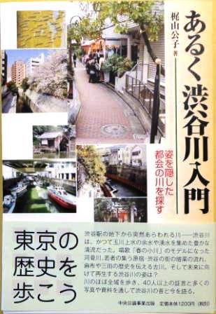 w to walk the Shibuya River'
 A pond in